
Last week VicGrid sent out an email letting people know that they have identified the preferred route and indicative easement for the transmission line to connect 2 gigawatts (GW) of offshore wind energy off the Gippsland coast to the electricity grid. A link in the email also showed a map showing where the transmission lines will likely go. A section of the proposed transmission line is planned to cut through 50 hectares of the north east section of Mullungdung State Forest, a forest that FoE's koala collective (SKAT) has been deeply involved in trying to protect.
The email also said "The preferred route is about 200 m wide and runs for about 60 km between the Loy Yang Power Station switchyard and a proposed new terminal station in Giffard. It is a defined area for the transmission line which will include a final easement – an area of land where transmission infrastructure can be built and maintained within the preferred route."
The email further says "This is an early version of the project design that shows one way the project could be built, so the EES can assess the project’s likely impacts and how they can be avoided, reduced or managed. While the reference design won’t change during the EES process, feedback will help shape the next stage of detailed design, including the final easement, tower locations and how the project is built."
Friends of the Earth is well aware that to construct the transmission lines that will connect offshore energy to the energy grid, the government is faced with the challenging task of balancing competing priorities. We will be pushing hard to make sure that Mullungdung does not come off as a Government "after thought".
Comments on the proposed route can be made here.

The proposed 60km transmission line in yellow connects the Gippsland Terminal Station at Giffard (yellow) with Loy Yang Power Station. The 50 hectare native forest area that will be removed (including 200 metre wide 'buffer') is marked in red. The location of the proposed Gippsland Terminal Station makes it almost impossible for the transmission line to avoid going through native vegetation.

The 50 hectare area proposed to be cleared is marked in red. Koala scats found during the recent visit are marked with pink pins. All were located in or near riparian zones of Little Monkey Creek and Monkey Creek. Friends of the Earth spent 5 years mapping koala locations in Mullungdung and Won Wron State Forests. This portion of Mullungdung was missed in the survey work due to a greater emphasis in the southern portion of the forest. It appears that Little Monkey Creek could be a Strzelecki koala hotspot extending over 4km's and possibly further, also being the main link between Mullungdung and the 600 hectare Giffard (Rifle Range) Nature Conservation Reserve and further east towards Giffard.
Last weekend Anthony Amis from SKAT visited and walked some of the area where the transmission line is planned to go. It appears that 50 hectares of Gippsland Plains Lowland Forest is likely to be removed with a 2.5km swathe of forest 200 metres wide planned to be destroyed. This is concerning as Friends of the Earth called for an 18,000 hectare reserve, including the area to be cleared, to be established at Mullungdung in February 2024.

The southern most section of the area proposed to be cleared is dominated by Yellow Stringybark (Eucalyptus muelleriana) covering about 6 hectares (see image above).
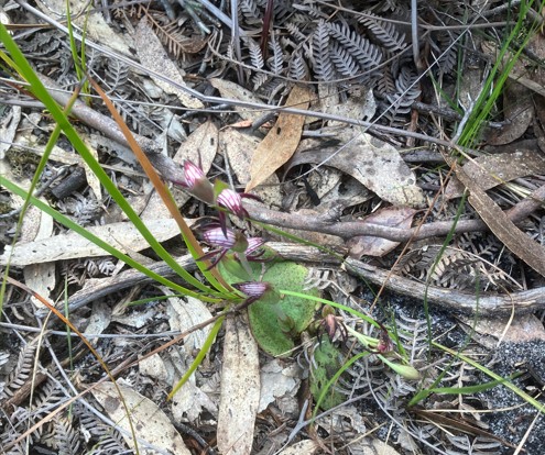
Undertaker Orchid/Red Beaks (Lyperanthus Nigricans) found in the Yellow Stringybark section of the forest (above)

Yertchuk/Banskia forest covers about 20% of the area to be cleared. FoE has observed Gang Gang Cockatoo's feeding on Yertchuk in nearby Won Wron State Forest.
Immediately north of the Yellow Stringybark area, within the 200 metre clearance zone is an area of 9 hectares of Banksia and Yertchuk (Eucalyptus consideniana), where the soil type is more sandy. This area also contains some heathland.
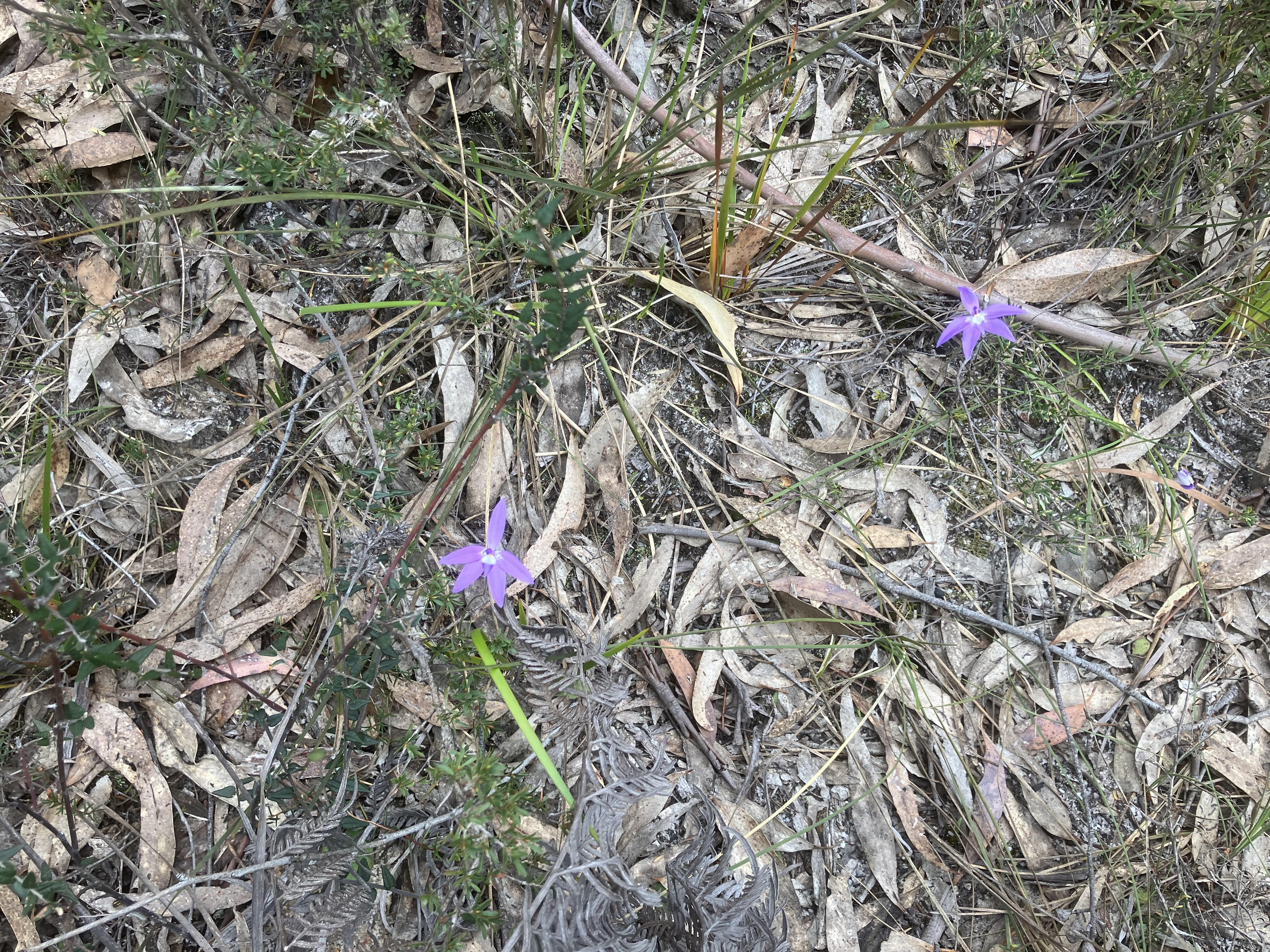
Pink Fingers Orchid (Caladenia Carnea) grows profusely in many areas within the logging zone.
North of the Banksia and Yertchuk, the forest changes again and is dominated by Yertchuk Woodland. This section is about 11 hectares in size.
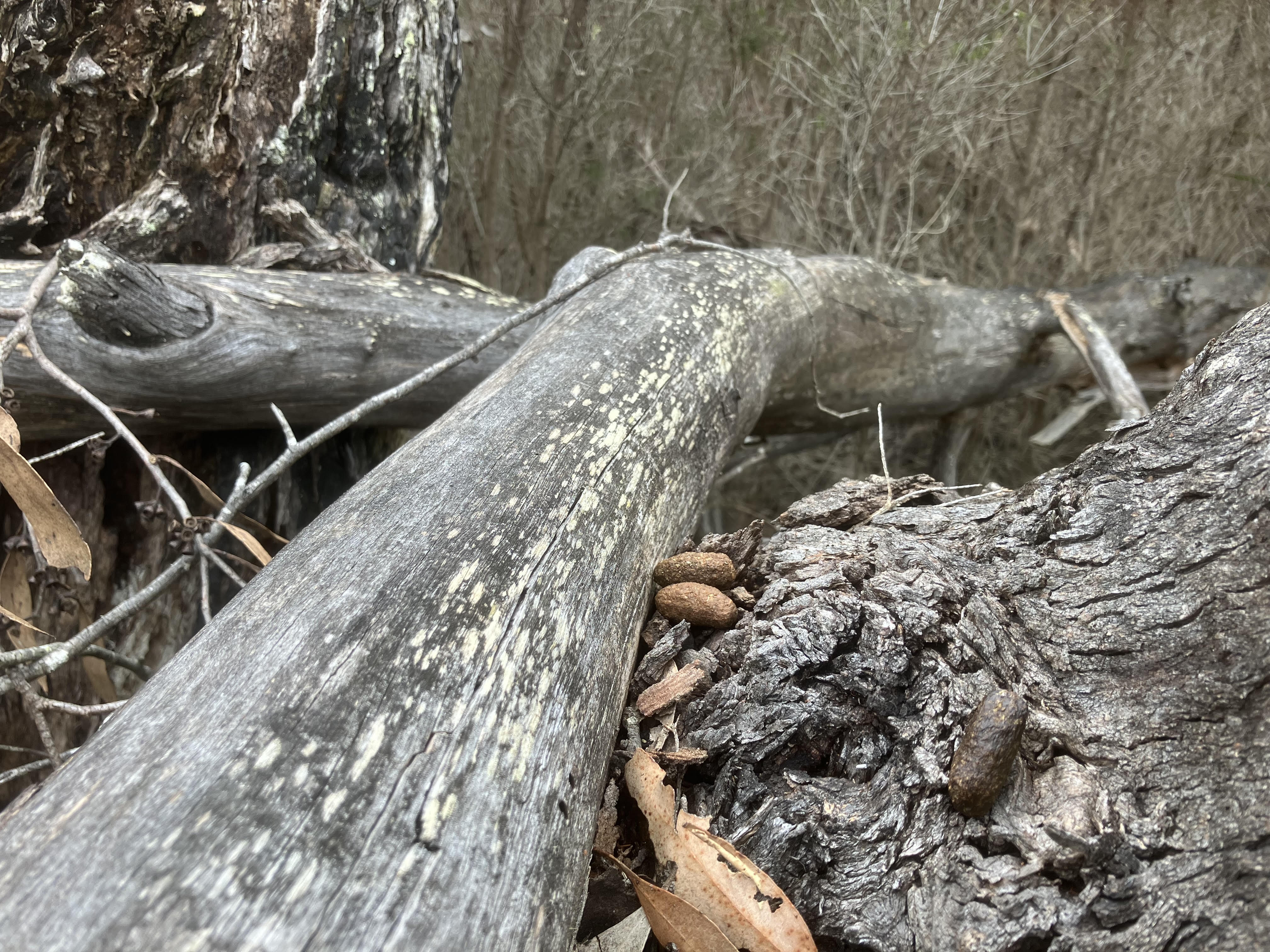
Koala scats on a Swamp Gum branch in Little Monkey Creek.
Immediately north of the Yertchuk, the Ecological Vegetation Class changes to Gippsland Riparian Scrub covering about 2 hectares. This is the riparian zone in Little Monkey Creek. A number of Swamp Gums (Eucalyptus ovata) were located here as well as a tree known as But But (Eucalyptus bridgesiana). 5 old koala scats were found under Swamp Gum and Yertchuk in this riparian zone. This follows a pattern SKAT has observed that koalas at Mullungdung utilise and are found in higher numbers in riparian zones.

Looking south into Little Monkey Creek Riparian zone, with the Swamp Gum having white/grey bark.
North of Little Monkey Creek the forest changes back to Yertchuk dominated Lowland Forest and heathland. This type of forest extends up to Monkey Creek Road and north to Monkey Creek and covers about 20 hectares.
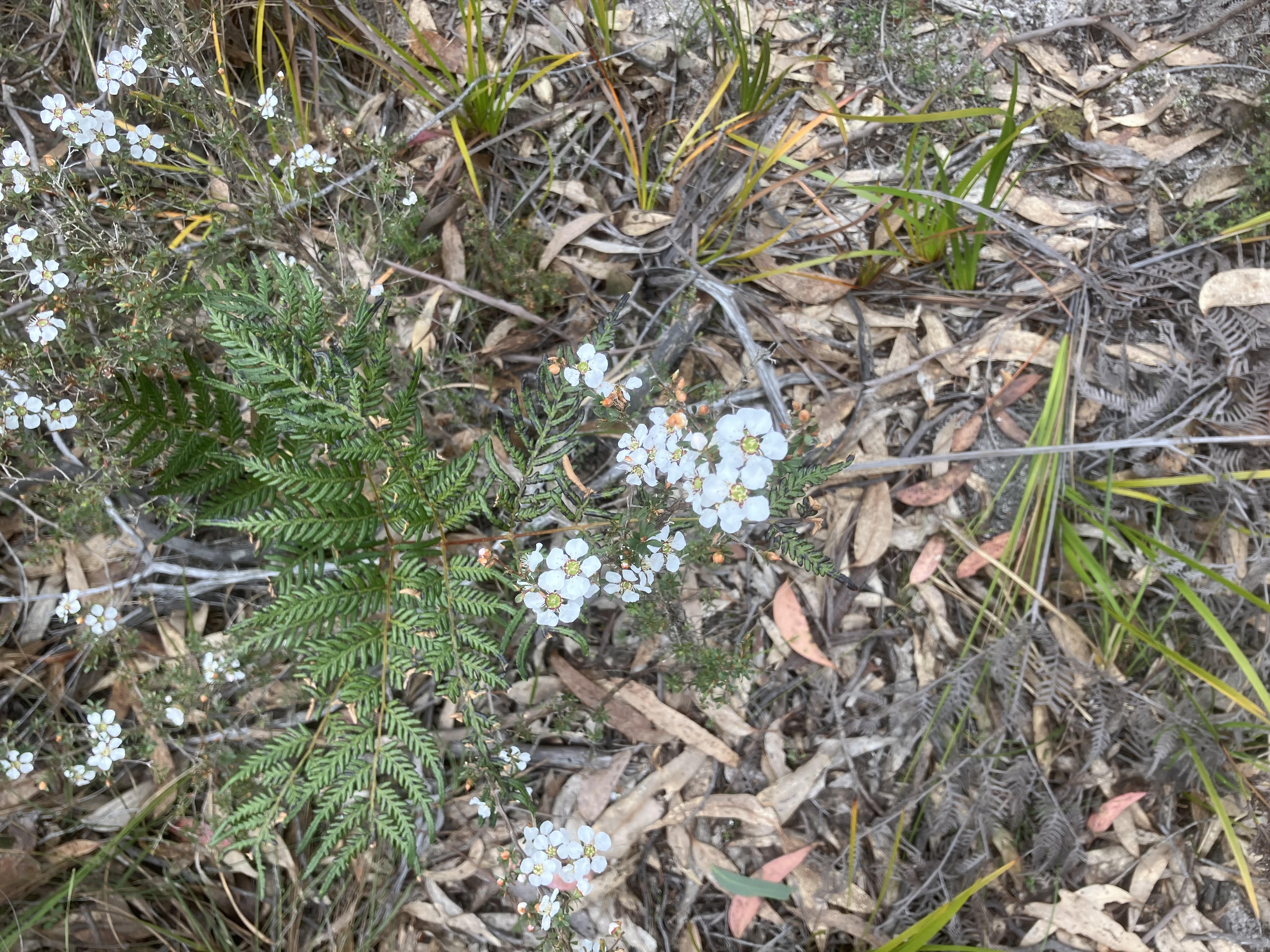
Heath Tea Tree (Gaudium myrsinoides) appears to grow more prolifically on the northern side of Little Monkey Creek. Many groundcovers were observed near this location.
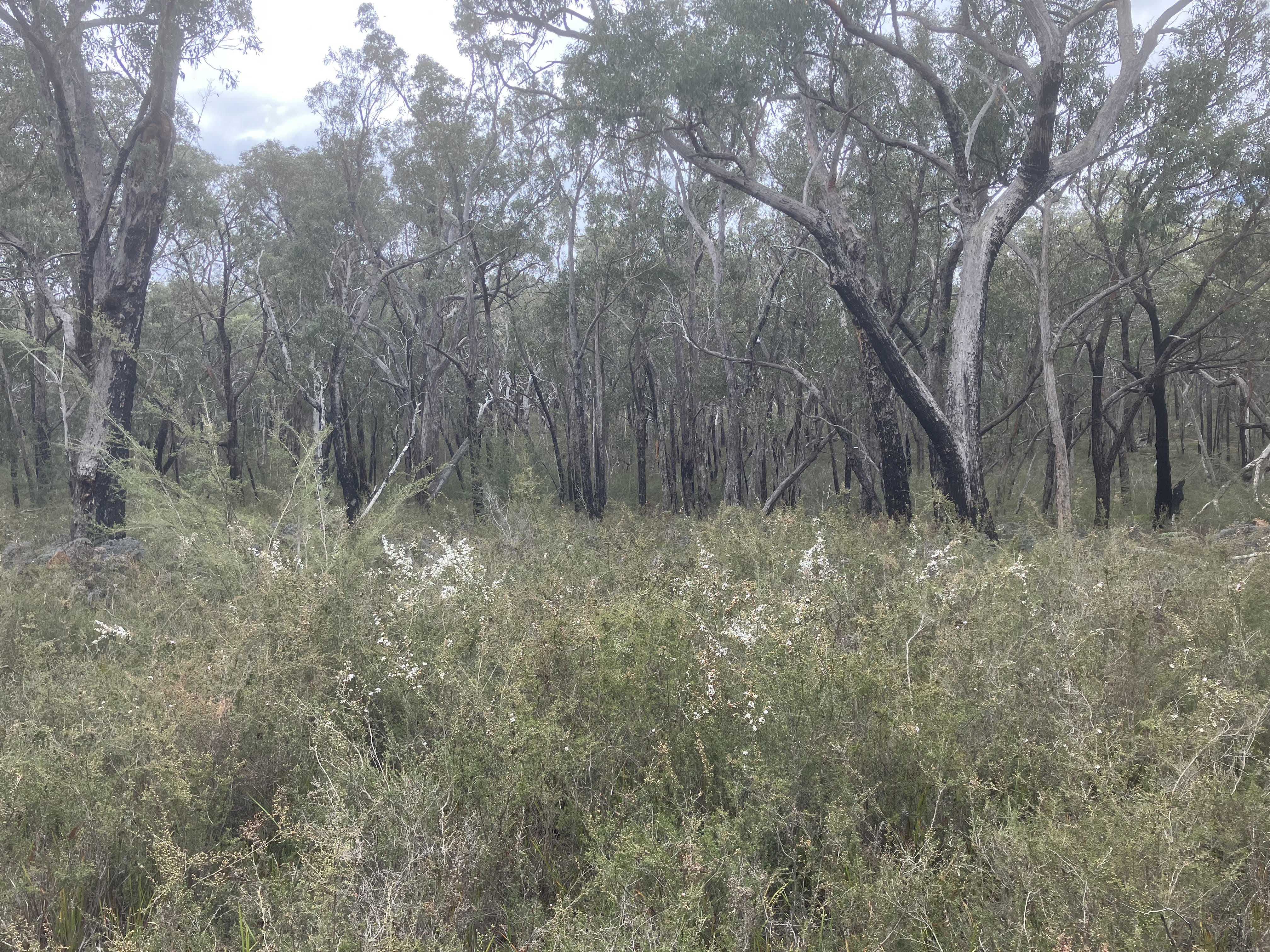
Heath Tea Tree in the Yertchuk forest which will be cleared.
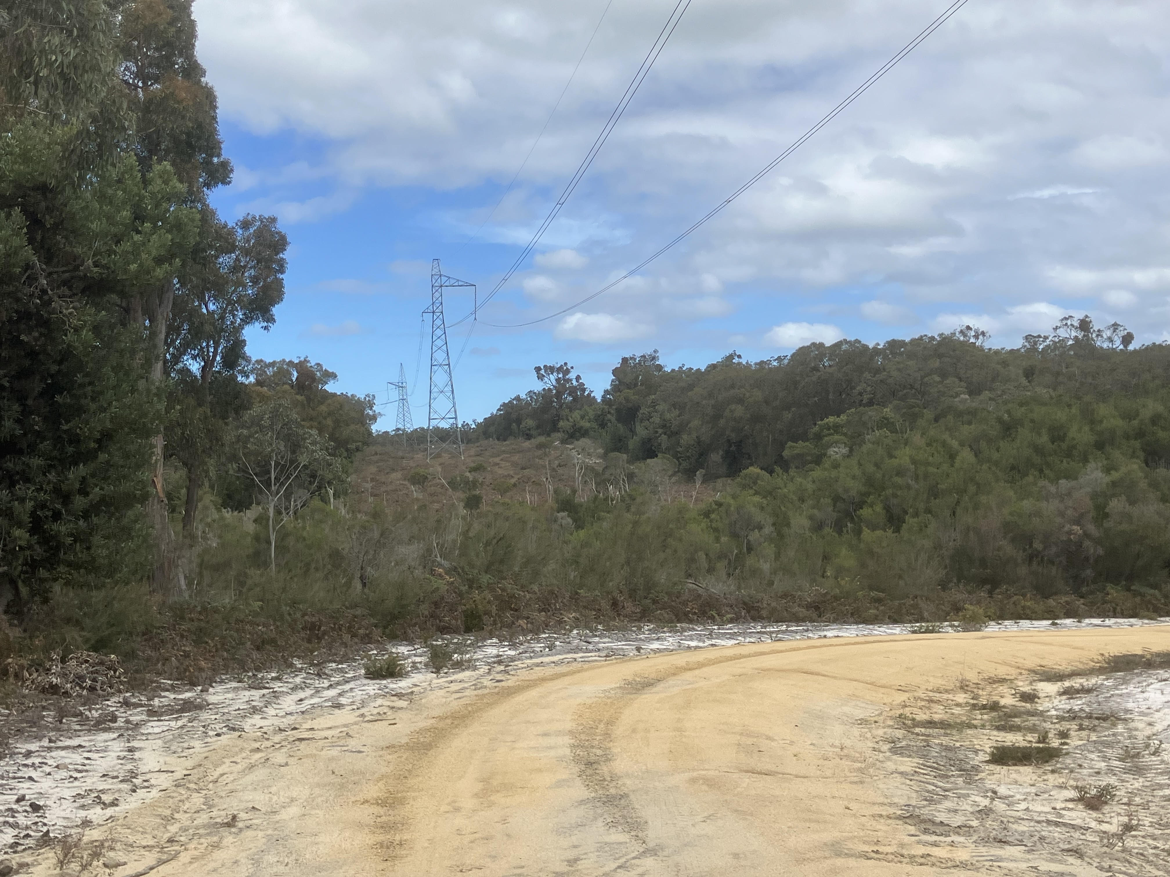
Monkey Creek is the northern most extent of the area that will be cleared. At this location there is an existing transmission line with a 50 metre buffer. The area to be cleared for the new transmission lines, can be seen to the right of this image and will be 200 metres wide. A koala scat was found under a Yertchuk near Monkey Creek in the area to be cleared about 100 metres from where this photo was taken.
A short youtube video clip was also taken on the site visit